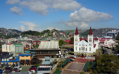
[9.9] Phivolcs, Baguio 지상 흔들림 위험 지도 출시
컨텐츠 정보
- 21,713 조회
본문
마닐라 – 필리핀 화산 지진학 연구소(Phivolcs)가 목요일 바기오 시 지반 흔들림 위험 지도(BCGSHM)를 공식 출범했습니다.
"도시의 급속한 도시화와 함께 건물 및 구조물의 개발 속도가 증가하고 있습니다. 도시의 독특한 특성, 특히 지형의 불규칙성으로 인해 지진 사이트의 매핑이 더욱 필요합니다"라고 말했습니다. Benguet 지방 과학 및 기술 이사 "Sheila Marie Claver"가 출시되는 동안 하이브리드 환경에서 개최되었습니다.
이러한 위험 지도는 지방 정부가 회복력이 있는 곳을 향한 개발 계획을 개선하는 데 도움이 될 것이라고 그녀는 덧붙였습니다.
BCGSHM은 과학기술부가 자금을 지원한 "바기오 시의 산악 지역에 적용할 수 있는 불규칙한 지형의 수동 지진층(PSSIT)" 프로젝트의 결과물 중 하나입니다.
"Claver"는 원래 이 프로젝트가 Baguio City만을 위한 것이었으나 확장되어 현재 La Trinidad Benguet을 포함한다고 말했습니다. 매핑이 현재 진행 중이라고 그녀는 말했습니다.
BCGSHM은 Phivolcs의 웹사이트를 통해 액세스할 수 있습니다. 여기에는 기저 토양과 암석층의 특성과 특정 지형(이 경우 바기오 시와 같은 산악 지형)의 영향을 기반으로 강진 시 지반 운동 및 현장 반응 수준에 대한 정보를 제공하는 지도가 포함되어 있습니다.
지난 7월 27일 규모 7의 지진이 루손 북서부를 강타하여 여러 구조적 피해를 입혔다는 것을 상기할 수 있습니다.
위험 지도는 바기오 시에서 지진에 강한 건물과 기반 시설을 설계하고 건설하는 구조 엔지니어에게 참조가 될 수 있습니다.
한편, 바기오 시티 런칭 당시에는 지방 정부, 민간 기업 및 토지 개발업자, 바기오 시티 내 대학 및 기타 이해 관계자를 대상으로 하는 기술 워크숍이 개최되었습니다.
진행자들은 지도에 표시된 데이터를 해석하고, 간행물을 사용하여 현장의 지반 조건을 식별하고, 건물의 자연 진동을 추정하여 강렬한 지진에 취약할 수 있는 기존 구조물을 결정하는 방법을 가르쳤습니다. (PNA)
This is the Original Article from PNA NEWS
[9.9] Phivolcs launches Baguio ground shaking hazard maps
MANILA – The Philippine Institute of Volcanology and Seismology (Phivolcs) officially launched on Thursday the Baguio City Ground Shaking Hazard Maps (BCGSHM).
"With the city's rapid urbanization, there has been an increasing rate in the development of buildings and structures. Due to the unique features of the city, especially the irregularities in the topography, all the more that it needs mapping of seismic sites," said Benguet Provincial Science and Technology Director "Sheila Marie Claver" during the launch held in a hybrid setting.
These hazard maps will help the local governments improve their development plans toward a resilient place, she added.
The BCGSHM is one of the outputs of the "Passive Seismic Stratigraphy of Irregular Topography (PSSIT) Applicable to Mountainous Areas of Baguio City" project funded by the Department of Science and Technology.
"Claver," said originally, this project was only for Baguio City, but has been extended and now includes La Trinidad Benguet. Mapping is currently ongoing, she said.
The BCGSHM can be accessed through the Phivolcs' website. It contains maps that provide information on the levels of ground motion and site response during strong earthquakes based on the characteristics of the underlying soil and rock layers and the effects of specific topography, in this case, mountainous terrain such as Baguio City.
It can be recalled that last July 27, a magnitude 7 earthquake jolted northwestern Luzon and resulted in several structural damages.
The hazard maps can be a reference for structural engineers in designing and constructing earthquake-resilient buildings and infrastructures in Baguio City.
Meanwhile, at the launch in Baguio City, a technical workshop was held to cater to participants from the local government, private firms and land developers, universities within Baguio City, and other stakeholders.
Facilitators taught them how to interpret the data presented in the maps, identify ground conditions on-site using the publication, and estimate the natural vibration of buildings to determine the existing structures that might be vulnerable to intense ground shaking. (PNA)
관련자료
-
이전
-
다음


